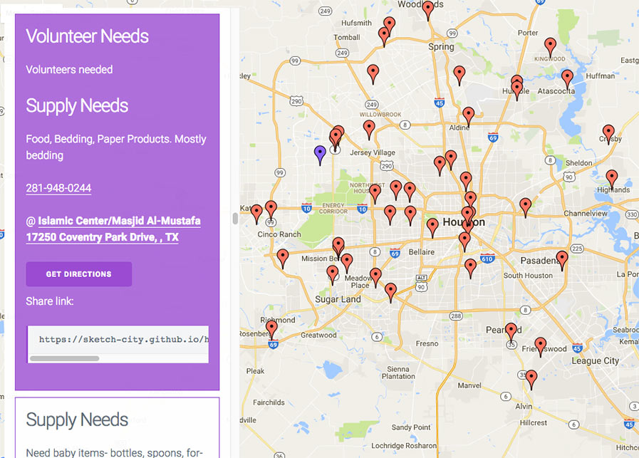
Here’s another helpful online tool from the civic hackers at Sketch City, this one for would-be volunteers: a crowdsourced, interactive map showing which shelters near you are in need of what resources — and which ones might need people to come over and help out. Each icon on the map represents a shelter or providing organization that’s helping evacuees who’ve been put out of their homes by Harvey flooding. Click on one and a panel on the left will indicate any supply needs or volunteer needs identified by the site. (A larger, full-browser-width version of the map is here.) The map was put together by Amanda Shih, Dr. Neeraj Tandon, and Chris Ertel, and is linked to data assembled and continually updated by a group of dozens of local and not-so-local volunteers hooked up to the project by Sketch City, a Houston nonprofit technology group. (The same bank of is behind Sketch City’s other new mapping project — one that simply identifies available Harvey shelters to people seeking them.) The volunteers have been making regular phone calls to update the information in a shared Google Doc. (If that kind of call-and-type-from-home work is your preferred method of volunteering, go ahead — you’ll find a direct link to the underlying spreadsheet in the map.) Harvey Needs [Sketch City on Github] Previously on Swamplot: The Quickest Way To Find the Nearest Hurricane Harvey Shelter That Isn’t Already Full … Read More